Draw a boundary on the map and let AI inspect your entire road network — detecting cracking and potholes, and scoring the condition of every segment.
How it works
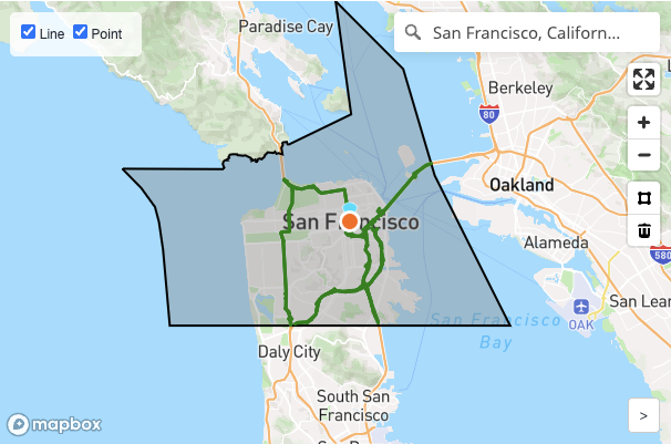
Sketch a boundary around any city, county or district. Road Robin pulls the road network from OpenStreetMap automatically — pick the road classes and sampling interval you care about.
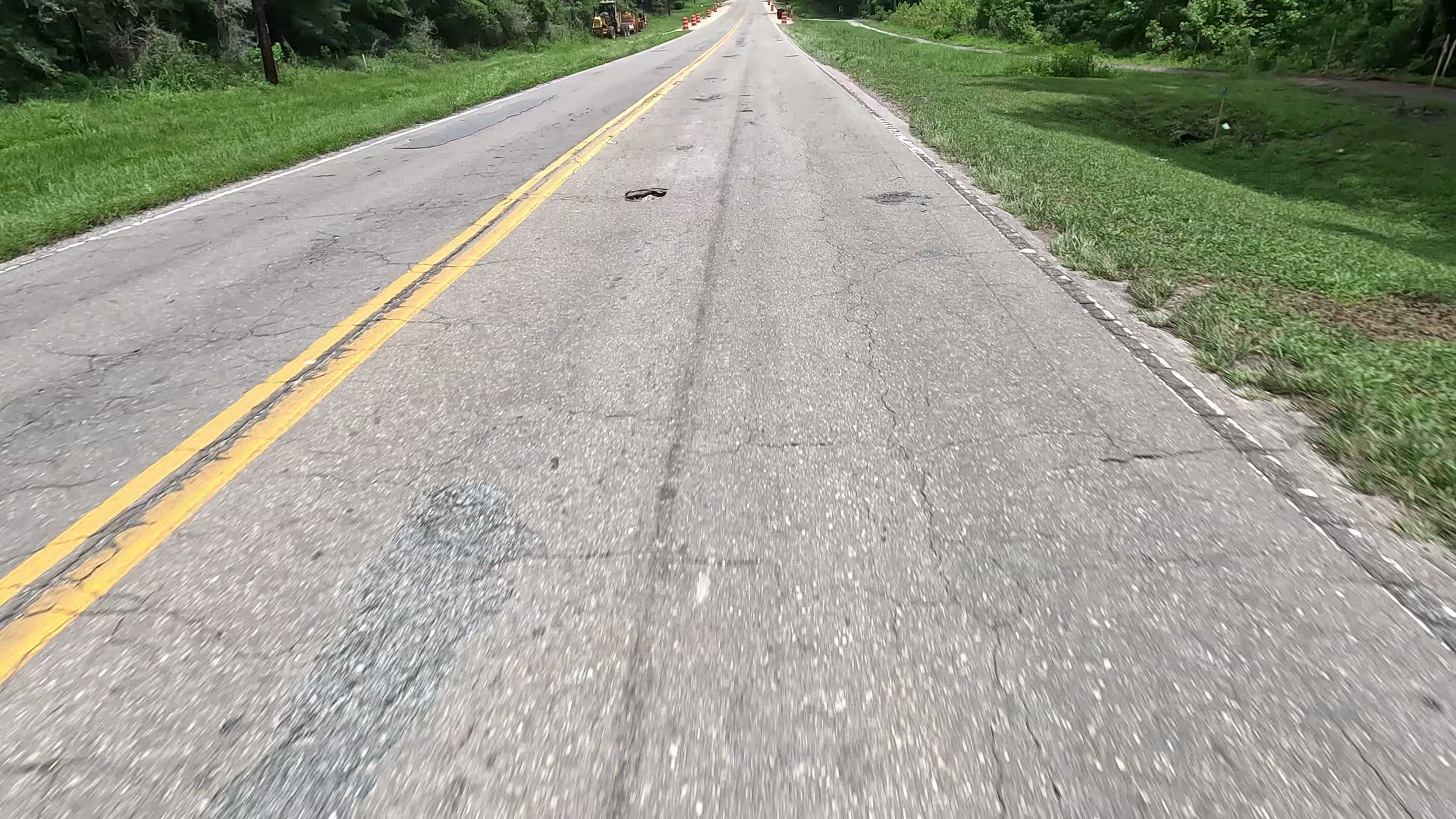
Our vision models analyze street-level imagery along every road — Google Street View or your own captures — detecting cracking and potholes with severity and extent for each.
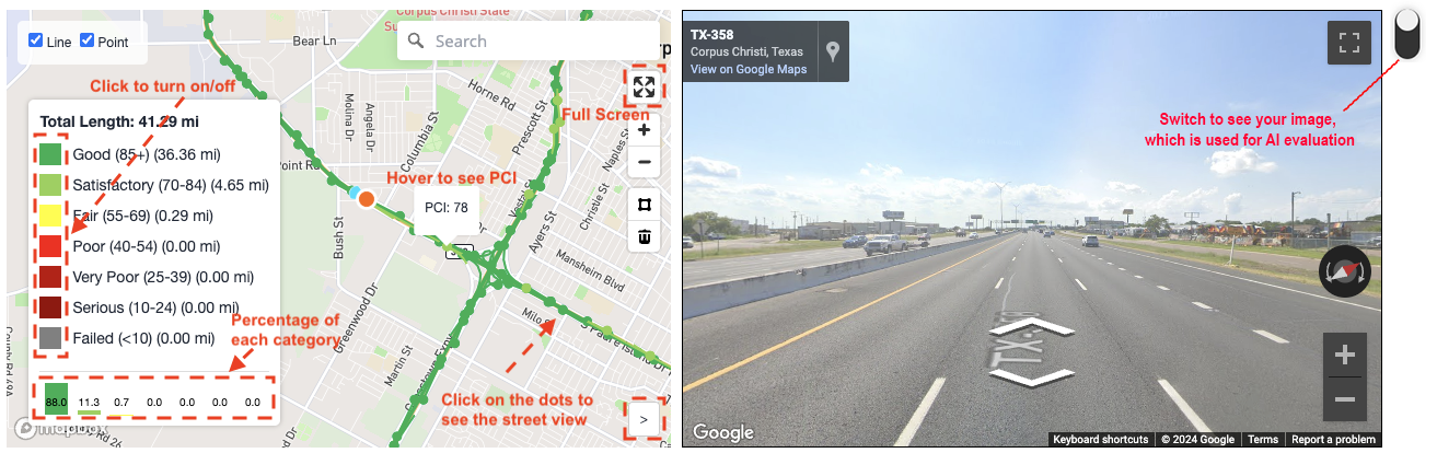
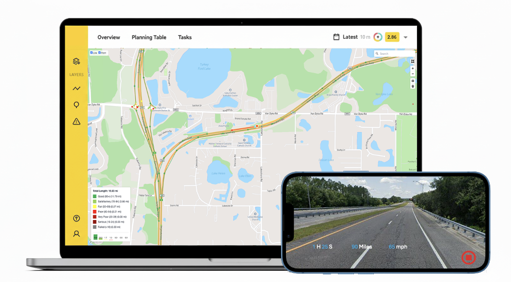
Every segment scored on a 7-tier condition scale, color-coded on an interactive map. Click any point to see the exact image behind its score. Export the data for your pavement management workflow.
See it in action
A live tour of assessed road networks — every segment colored by condition, from healthy green to failed gray.
Capabilities
Built for cities, counties, DOTs and engineering firms that manage pavements at network scale.
Assess any network using existing street-level imagery. Get a defensible baseline for hundreds of miles in a single afternoon.
Capture your roads with a dashcam, phone or action camera — upload the footage and Road Robin turns it into analysis-ready, mapped imagery automatically.
Each segment is scored on a standard 7-tier condition scale — from Good to Failed — so results plug straight into your existing management practice.
Not just a score: severity and extent for cracking and potholes at every evaluation point, with the underlying image one click away.
Explore your network color-coded by condition, filter by category, see the share of miles in each tier, and jump to street view for any point.
Aggregate completed projects into a portfolio view and use deterioration modeling to prioritize maintenance before roads slip into costly rebuilds.
Beyond detection
Detection is only the beginning. Road Robin forecasts how your network will age, ranks what to fix first, and squeezes the most condition improvement out of every budget dollar.
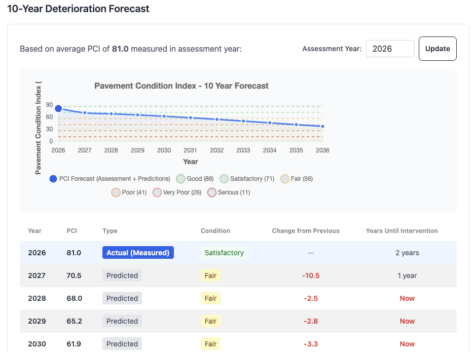
Deterioration models project every segment's condition a decade forward, so you know not just what shape your roads are in — but when each one will cross the threshold where preventive work turns into expensive reconstruction.
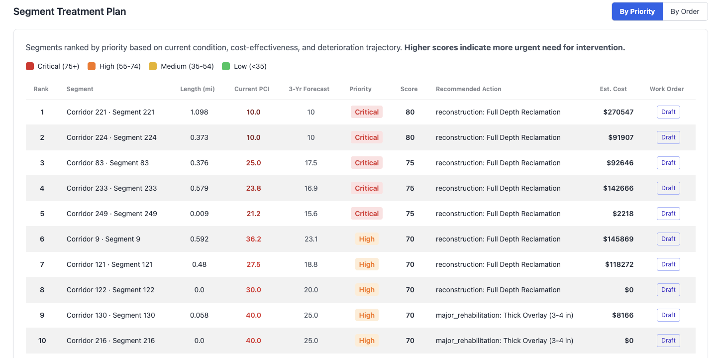
Every segment gets a priority score from its condition, deterioration trajectory and cost-effectiveness — with a recommended treatment and estimated cost. Draft a work order straight from the plan.
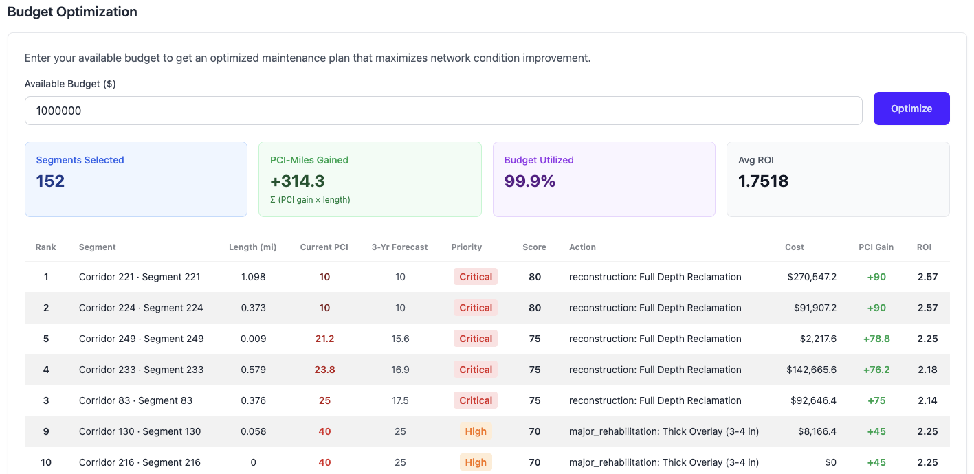
Enter your available budget and the optimizer selects the mix of treatments that maximizes condition improvement across the network — showing budget utilization and return on investment for the whole program.
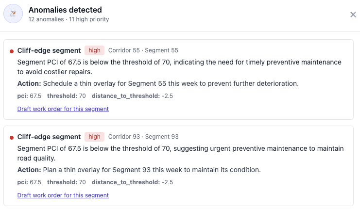
Road Robin's AI agent flags anomalies before they become emergencies — like cliff-edge segments about to slip below the preventive-maintenance threshold — explains why they matter, and drafts the work order for you.
Flexible by design
The fastest path to a network baseline. Road Robin samples imagery along every road in your boundary and evaluates it — ideal for initial assessments, grant applications and screening large areas.
Need fresher or higher-detail imagery? Drive the route with any camera, upload the footage, and Road Robin takes care of the rest.
Sign up, draw your first boundary, and get a network-level condition assessment today.